By Meagan Krupa
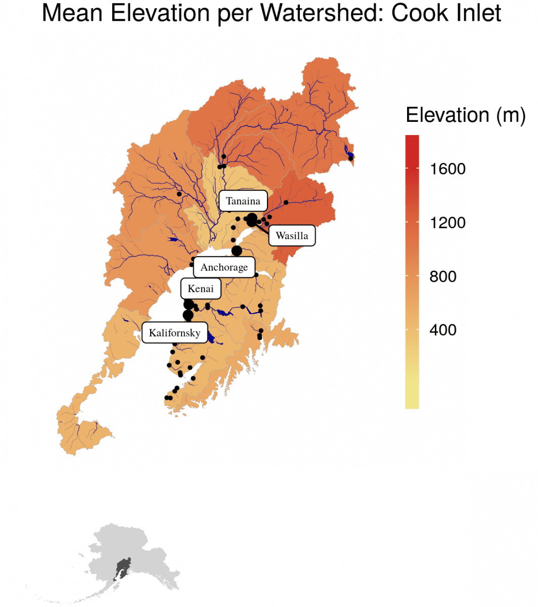
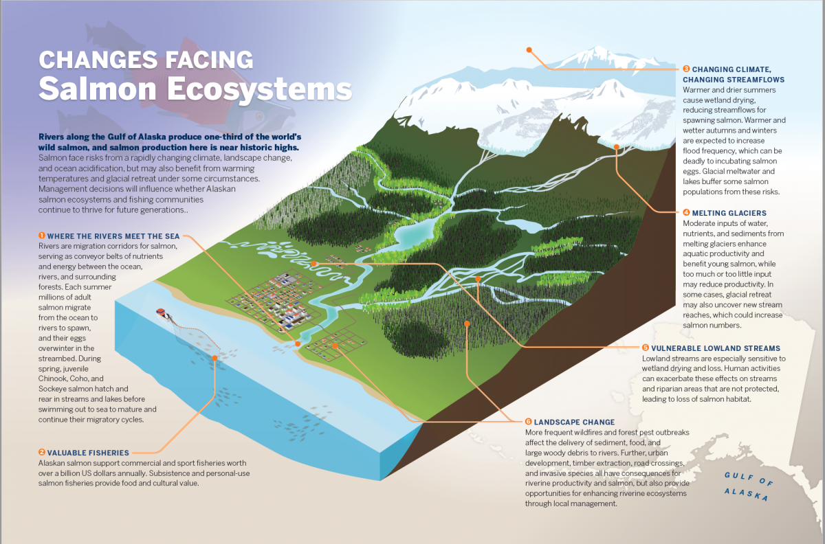
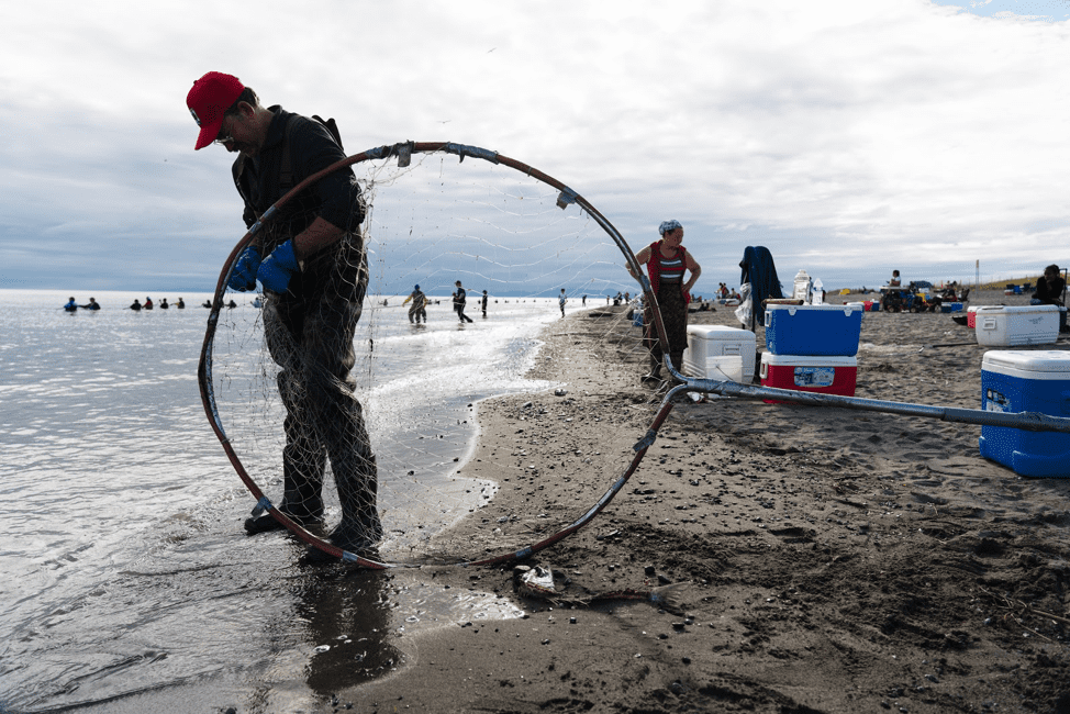
The glacially fed Kenai River drains the Kenai Peninsula of Alaska in Southcentral Alaska. It runs 82 miles (132 km) westward from Kenai Lake in the Kenai Mountains through the Kenai National Wildlife Refuge and Skilak Lake to its outlet into Cook Inlet. Its salmon-rich waters draw anglers from all over the world. Approximately 40 species of resident and anadromous fish live within the waters of the Kenai River and its tidal area. Chinook (Oncorhynchus tshawytscha), sockeye (Oncorhynchus nerka), and coho (Oncorhynchus kisutch) salmon are among the most commonly fished species.
To help address the future uncertainty of the Kenai River Fishery, a team of interdisciplinary researchers from the University of Alaska Anchorage developed a participatory research program called Salmon 2050. The program was funded by the National Science Foundation’s Established Program to Stimulate Competitive Research (#OIA-1208927) and the State of Alaska. Salmon 2050 analyzed biological, physical, economic, and social data to identify stakeholders and then worked with these stakeholders to produce five scenarios for the Kenai River Fishery.
The team utilized a research process called participatory scenario planning (PSP), which enables local communities to envision their response to future uncertainties through the development of scenarios. As PSP researchers strive to improve stakeholder engagement by increasing the legitimacy and transparency of the process, the initial identification of stakeholders has the ability to jeopardize or enhance the overall process.
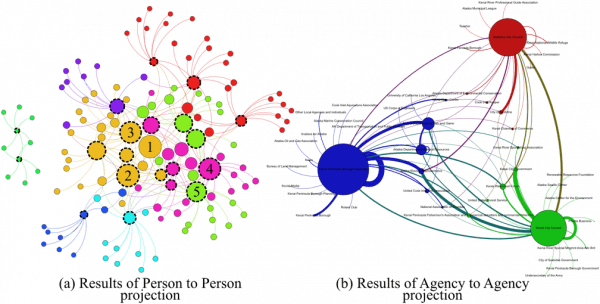
Graph: Communication network for the elected officials of Kenai Borough.
(a) Person-to-person projection: Circles represent stakeholders and the lines connecting two stakeholders represent the communications. Interviewed elected officials are circles with dashed border. The node size is proportional to the node’s Eigenvector centrality and the same node color groups highly interconnected stakeholders into communities.
(b) Agency-to-agency projection: Network circles represent agencies and the lines represent people communicating across agency boundaries. The self-leading lines represent the communication patterns among multiple stakeholders belonging to the same agency. The node size and line thickness is proportional to the total number of communication exchanges.
The team discovered that Social Network Analysis (SNA) provides an efficient and transparent way to identify and characterize stakeholders for the scenario planning process (Krupa et al. 2017). SNA is the study of the relations between actors. It is a quantitative methodology that employs graph theory and sociograms to analyze and visualize social relationships, where nodes in the graph represent the actors (or sometimes other observations of interest, such as organizations), and the edges or lines between them represent their relationships.
After the SNA was completed, the team invited the individuals identified in the SNA to two PSP workshops to design the scenarios. Scenario development is one way that scientists can work with local communities to build a decision support tool that enables a diverse group of participants to step out of their usual management routines and identify pathways to achieve shared models of the future (Beach and Clark 2015). Scenario planning considers multiple plausible futures with multi-faceted variables that have high uncertainty. It links past and present events with hypothetical courses that examine the relationships of driving forces (Trammell et al. 2017). The goal of scenarios is to create more robust planning for events that may be unpredictable (Peterson et al. 2003, Ralston and Wilson 2006, Weeks et al. 2011).
The stakeholders produced five scenarios and identified six key future uncertainties, which were used to produce the table below (Trammell and Krupa, in prep.). The scenarios range from the Kenai River as a retirement community; an industrial area with a small fishery; a global fishing destination; small commercial and sport fisheries; to an entirely hatchery-supported local personal use fishery.

Given the future uncertainties, it is difficult to predict exactly how the Kenai River Fishery will look in the future. What is known is that the future will largely be the result of both the intended and unintended consequences of decisions that are made by communities. Therefore, local communities will benefit from thinking about the potential for change and how their actions today can lead them to a more desired future landscape.Scenarios Cross Comparison – This table shows how the narratives compare to one another in relation to the key uncertainties defined at the first workshop.
References
Alaska Department of Fish and Game (ADFG). 2018. The Kenai River. Recreational Fishing Series, Division of Sport Fish, Southcentral Region, Anchorage, AK. Online: https://www.adfg.alaska.gov/static-sf/Region2/pdfpubs/kenairiver.pdf
Beach, D. M., and D. A. Clark. 2015. Scenario planning during rapid ecological change: lessons and perspectives from workshops with southwest Yukon wildlife managers. Ecology and Society 20(1): 61. http://dx.doi.org/10.5751/ES-07379-200161.
Cook Inlet Aquaculture Association (CIAA). 2015. Fry/Smolt Release Data. Online: http://ciaanet.org/data/fry-smolt-release.html.
Krupa, M.B., M. Cenek, J. Powell, and E.J. Trammell. 2017. Mapping the Stakeholders: Using Social Network Analysis to Increase the Legitimacy and Transparency of Participatory Scenario Planning. Society and Natural Resources, DOI: 10.1080/08941920.2017.1376140
Peterson, G. D., T.D. Beard, Jr, B.E. Beisner, E.M. Bennett, S.R. Carpenter, G.S. Cumming, C.L. Dent, and T.D. Havlicek. 2003. Assessing future ecosystem services: a case study of the Northern Highlands Lake District, Wisconsin. Conservation Ecology 7(3): 1. [online] URL: http://www.ecologyandsociety.org/vol7/iss3/art1/.
Ralston, B., and I. Wilson. 2006. The scenario planning handbook: a practitioner’s guide to developing and using scenarios to direct strategy in today’s uncertain times. Texere, New York, New York, USA.
Trammell, E. J., S. Thomas, D. Mouat, Q. Korbulic and S. Bassett. 2017. Using alternative land use scenarios to facilitate natural resource management across jurisdictional boundaries. Journal of Environmental Planning and Management, DOI: 10.1080/09640568.2017.1289901
Trammell, E.J. and M.B. Krupa. In prep. Participatory Scenario Planning on Alaska’s Kenai Peninsula.
Weeks, D., P. Malone, L. Welling. 2011. Climate change scenario planning: a tool for managing parks into uncertain futures. Park Science 28(1):26-40.
