Leveling the Information Playing Field Through Access to Salmon Data
A major goal of the SASAP project is to make relevant salmon information accessible and usable by Alaskans wishing to advocate on their own behalf for a better salmon future. More than 115 of the most important datasets underpinning SASAP knowledge are now freely available for personal use to support proposals to the Board of Fisheries, assist with management decisions, or provide background for advocacy or education.
There are two ways to access SASAP’s datasets, along with colorful, downloadable graphs and charts:
Direct DOI links
DOI (Digital Object Identifier) links are placed in the captions of each of the graphs on the SASAP website, and within many of the references at the end of each Region chapter or Topics story. DOI links take you directly to the associated datasets and graphs.
Salmon Data Portal
Created by NCEAS’ Data Task Force, the Salmon Data Portal provides built-in tools to help sort through and identify the most relevant datasets. Tabs across the top of the Data Page offer choices to narrow your search: the Geography tab allows selection of watershed, community or region. Theme tab choices include different types of fish productivity data, habitat data or human dimensions data. The People and Organizations tab allows selection of data from specific agencies or working groups.
Datasets that contain the desired information appear below the tab section. Clicking on any of the sets leads to associated data files and graphs. In the example in Figure 1, the current search selected three data sets containing sociocultural information on Chinook in the Yukon River. Tabs selected: Geography – Yukon; Species – Chinook; People and Organizations – Sociocultural Working Group). Clicking on the first dataset leads to associated data files and downloadable graphs (Figure 2).
People who use the data are requested to cite the dataset they are using. The citation is listed at the top of the page in the dataset.
Note: We have attempted to make datasets available to any user by ensuring that each can be opened using open-source (free) software. However, some datasets will require a higher level of technical expertise to use due to size or to specialized data formats such as geospatial data.
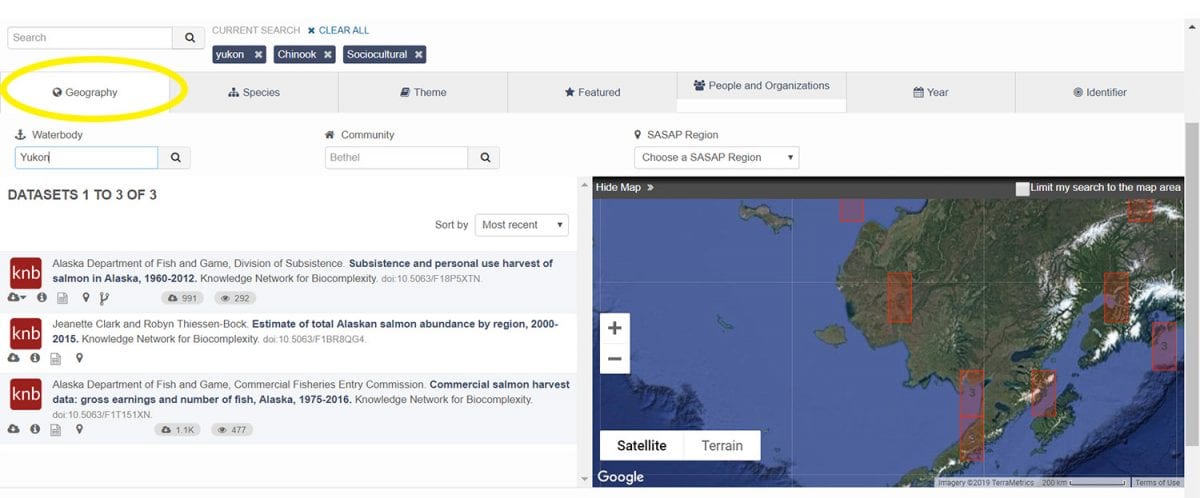
Figure 1.
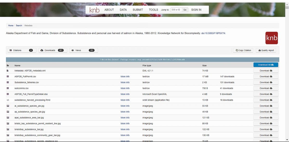
Figure 2.